
Benefits
Eliminates manual data entry from hundreds of flood certificates per day, freeing underwriters and loan officers for higher-value review work.
Reduces errors in flood zone classification and BFE reporting that can lead to mispriced premiums, incorrect loan-to-value ratios, and regulatory non-compliance.
Accelerates mortgage closing timelines by delivering structured flood determination data in seconds instead of hours.
Provides auditable extraction output with source references, supporting CRS documentation and regulatory file reviews.
How it works
- Step 1
Upload
Send the document to the API as a file or a URL no special formatting required.
- Step 2
The engine reads the document
The engine analyzes the page layout and identifies the content that matters. The extraction engine reads the full flood certificate, including FEMA form sections A through G, flood zone maps, elevation tables, community jurisdiction blocks, and lender-specific data fields, and returns them as structured, labelled data.
- Step 3
Structured JSON is returned
Every extracted element comes back as structured JSON, positioned and typed, ready to feed into downstream systems.
- Step 4
Confidence-based review
Each field carries a confidence score, so low-confidence results can be routed for human review instead of trusted blindly.
Extractable fields
Features
Detects all FEMA Elevation Certificate versions (2009, 2012, 2015, 2018, 2022, 2026) and processes lender-specific flood certification forms automatically.
Extracts core flood data including property address, flood zone, BFE values, community name and number, building elevation measurements, and NFIP community jurisdiction.
Processes scanned PDFs, photographs of elevation certificates, and multi-page flood determination reports with OCR powered by advanced vision-language models.
Returns structured JSON or Markdown output with source snippets, ready for ingestion into loan origination systems, insurance underwriting platforms, or workflow automation tools.
Use cases
Mortgage origination flood determination
When a mortgage application enters processing, lenders must determine whether the property lies in a Special Flood Hazard Area (SFHA) and calculate required flood insurance coverage. By feeding flood certificates into ByteIt's API, loan officers receive flood zone, BFE, and community data as structured fields that can be checked against lending guidelines and passed directly into the loan origination system, cutting turnaround from hours to seconds.
Insurance underwriting and premium calculation
Insurance carriers need elevation data and flood zone designations to price flood policies accurately. ByteIt extracts BFE values, building elevation measurements, and flood risk zones from FEMA Elevation Certificates, enabling underwriters to calculate premiums based on actual risk factors rather than manual lookup from scanned forms.
Portfolio risk analysis and compliance reporting
Financial institutions holding property portfolios must regularly audit flood risk exposure and maintain CRS documentation. Automated extraction enables bulk processing of hundreds or thousands of flood certificates into a structured database, making it possible to run portfolio-wide flood risk reports, identify properties that require additional coverage, and produce audit-ready documentation for regulators.
Community Rating System (CRS) documentation
Local floodplain managers participating in FEMA's CRS programme maintain elevation certificates to document community flood risk management. ByteIt structures the data from ECs into a consistent format that can be sorted by property, zone, or elevation value, supporting the record-keeping and reporting requirements that earn community-wide flood insurance premium discounts.
Workflow automation for loan and insurance pipelines
Extracted flood certificate data can be connected to downstream systems through workflow automation tools such as n8n, Zapier, or Make. A property address and flood zone can trigger automatic updates to a loan file, generate a flood insurance quote request, or flag a property for manual review, all without an operator touching a keyboard.
LIVE DEMO
Try it yourself
Upload a sample flood certificate in PDF, JPG, or PNG format and see the extracted flood zone, BFE, and property data returned as structured JSON in seconds.
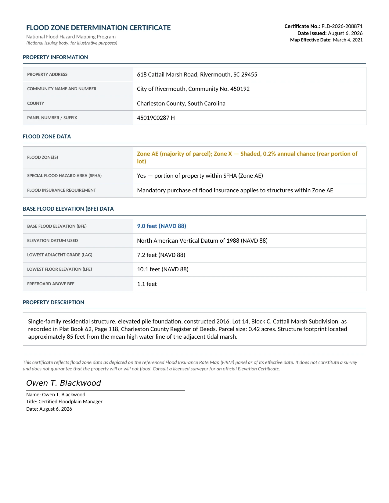
Select a document and press Parse
Want to run it on your own documents?
Ready to dive in? Request a key to get started.Business advantages
- Sub-second latency, process single flood certificates in under two seconds.
- Free tier included, 1,000 documents per month at no cost.
- GDPR-compliant data handling with end-to-end encryption.
- Developer-first REST API with Python SDK and comprehensive documentation.
Frequently asked questions
How does ByteIt handle different versions of FEMA Elevation Certificates?
ByteIt automatically detects which FEMA form version a certificate uses, from the 2009 version through the 2026 update, and adjusts extraction logic accordingly. No manual template selection is required. The engine also handles lender-specific flood certification forms that do not follow the standard FEMA layout.
What file formats are supported for flood certificates?
ByteIt accepts PDF, JPEG, PNG, TIFF, Word, and Excel files. Scanned paper certificates and photographs of elevation certificates are processed using OCR, so the originals do not need to be born-digital.
How can I integrate flood certificate extraction into my existing workflow?
ByteIt exposes a simple REST API. You can send a POST request with the flood certificate file and receive structured JSON or Markdown in the response. A Python SDK is also available. For no-code automation, extracted data can be routed into downstream systems using tools like n8n, Zapier, or Make.
How much does flood certificate processing cost?
The Build plan is free and includes 1,000 documents per month with full extraction capabilities. The Scale plan costs 260 € per month for 25,000 documents. Enterprise plans with custom pricing, zero data retention, VPC or on-premise deployment, and dedicated support are available for higher volumes.
Does the extraction handle multi-page flood certificates?
Yes. Flood certificates can run several pages, especially when they include full FEMA Sections A through G with elevation diagrams and FIRM panel maps. ByteIt processes all pages in a single API call and returns the extracted data as one coherent JSON object.
Can I use it for properties outside the United States?
The flood certificate model is optimised for US FEMA Elevation Certificates and lender-issued flood zone determination reports. If your documents use a different country's flood risk framework, contact ByteIt to discuss support for additional formats.
Related documents
Contracts
Extract parties, contract clauses, signatures, and applicable law from legal contracts using ByteIt's structured data extraction API. Supports PDFs and scanned documents.
Insurance Claims
Extract structured data from insurance claim forms and supporting documents automatically. Claimant details, policy numbers, loss descriptions and more in seconds.
Permits
Extract structured data from building permits, environmental permits, and regulatory licences with AI. Capture dates, signees, clauses, risk keywords, and more.
Energy Certificates
Extract structured data from energy certificates with ByteIt's AI engine. Capture energy labels, consumption data, GHG ratings, and more from PDFs and images.
Articles Of Incorporation
Extract corporate name, share structure, registered agent, incorporators and more from articles of incorporation. OCR API for entity management and compliance.